Cultural Landscapes Scanner (CLS): Earth Observation and automated detection of subsoil undiscovered cultural heritage sites via AI approaches
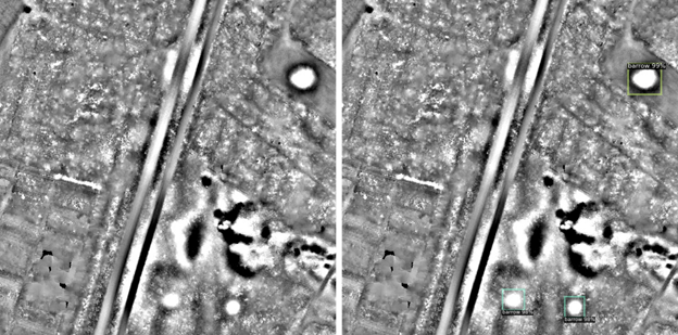
Research domain: Computational Sciences - Subtopic: Satellite images & Cultural heritageSub-surface, yet-undiscovered Cultural Heritage sites (CH) can be identified on Remote Sensing (RS) data from a variety of sensors (multispectral, hyperspectral and radar satellite platforms, etc.) in the form of anomalies or traces detectable on bare soils, crops or vegetation. The current extraordinary availability of free RS data through platforms like Copernicus cannot however be fully exploited because the quantity of data is not manageable by traditional manual processing and ‘human’ visual interpretation. To make the process efficient and speed up the procedure it is necessary to develop Artificial Intelligence (AI) methods to automatically process the data. The CLS project takes charge of this by supporting the development of methods that aim at automatically identify specific CH objects and patterns related to anthropogenic interference on landscapes using latest breakthroughs in Machine Learning and Computer Vision. In particular, this project seeks to kick start the application of cutting-edge computational methods in order to define a broad-spectrum, adaptable and robust automated recognition procedure customised for CH objects in data from Copernicus platform. Automating remote sensing analytics via Artificial Intelligence will produce large benefits in terms of archaeological object detection and represents a significant breakthrough in the discipline as it will replace existing procedures based on subjective observation.
Project funding: European Space Agency (ESA)

Photo: LiDAR data used in this image property of University of Leiden, courtesy of Wouter B. Verschoof-van der Vaart. Data processing ©CCHT-IIT.
