OPtimal Transport for Identifying Marauder Activities on LiDAR (OPTIMAL)
Research domain: Computational Sciences - Subtopic: Satellite images & Cultural heritageIllegal excavation of archaeological sites aimed at collecting historical material culture (""looting"") is a pressing problem on a global scale. The global upsurge of in the illegal excavation of cultural heritage sites (e.g. in connection to turmoils in Middle East or due to the impossibility of monitoring inaccessible areas, like in South America) and the subsequent trafficking of antiquities, exacerbated by the Covid lockdown, calls for the timely development of automatic means for identifying looting activities. The OPTIMAL (OPtimal Transport for Identifying Marauder Activities on LiDAR) project aims to tackle this challenge by developing an efficient and principled Machine Learning (ML) approach based on Optimal Transport to automatically detect looting (past and present) directly on airborne Light Detection And Ranging (LiDAR) point cloud time-series. OPTIMAL proposes, for the first time, the use of LiDAR for monitoring and assessing the damages of looting based on LiDAR’s unique ability to penetrate forest canopies and enabling to see a range of looting-related features under the canopy (e.g. shape and depth of the lootings pits) that otherwise would remain hidden due to vegetation covers. OPTIMAL will create and make publicly available the first multi-temporal LiDAR dataset for illegal activities’ identification to foster the interest of MLs researchers in developing new methods to tackle challenges in landscape archaeology and to evaluate the developed ML approach. Results of this interdisciplinary research will be widely disseminated within Cultural Heritage, Remote Sensing and Machine Learning communities and to others that can exploit OPTIMAL’s results. A communication strategy will be designed to ignite enthusiasm for technological advancements for the protection of our Heritage.
Project funding: European Commission (EU)

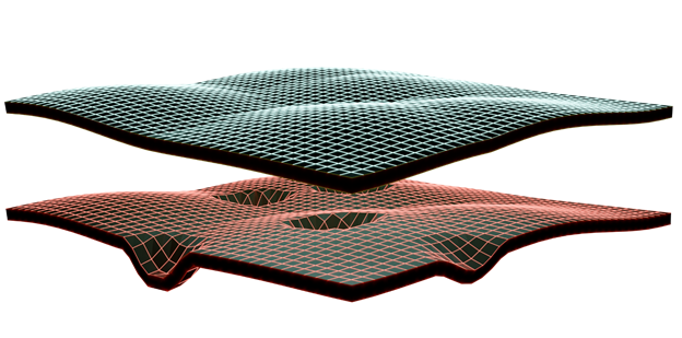
A LiDAR point cloud pair, (PC(t),PC(t+ Δt)), captured at two successive points in time, t and t+ Δt for looting detection.

